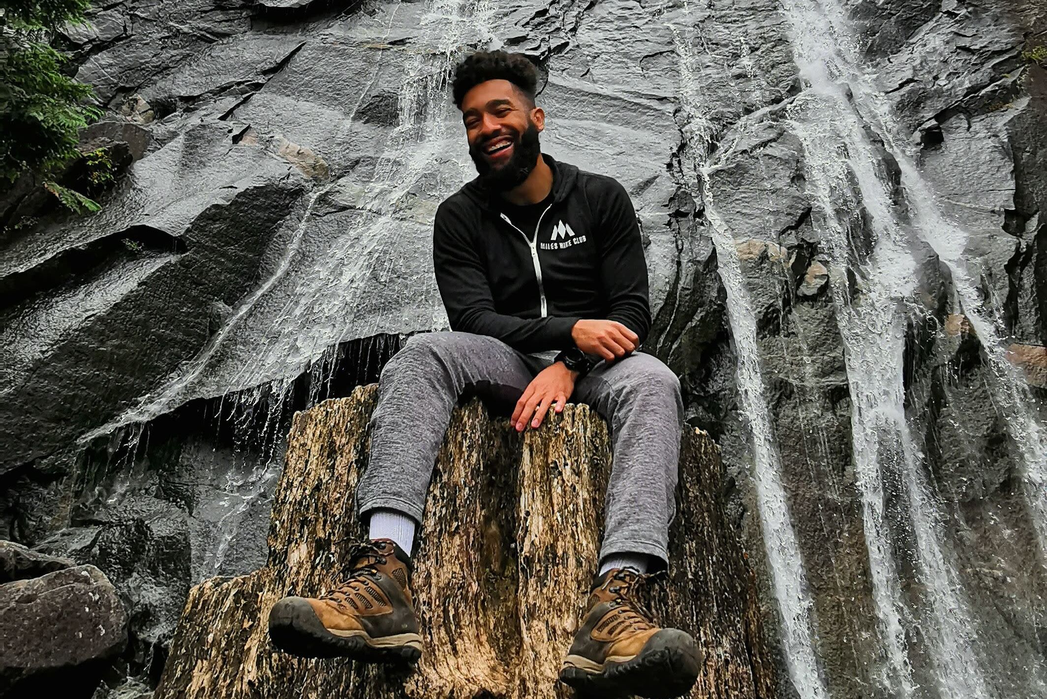
Best Washington Hikes
Photograph by Nate Brown.
Hiking is practically our state sport. It’s no wonder, given that Western Washington is a spiderweb of trails to mountaintops and lakes, through forests and tidal zones. When recreating outdoors in the Pacific Northwest, remember to pack the 10 Essentials and research trails thoroughly. The encyclopedic website from nonprofit Washington Trails Association contains a wealth of vital outdoor info.
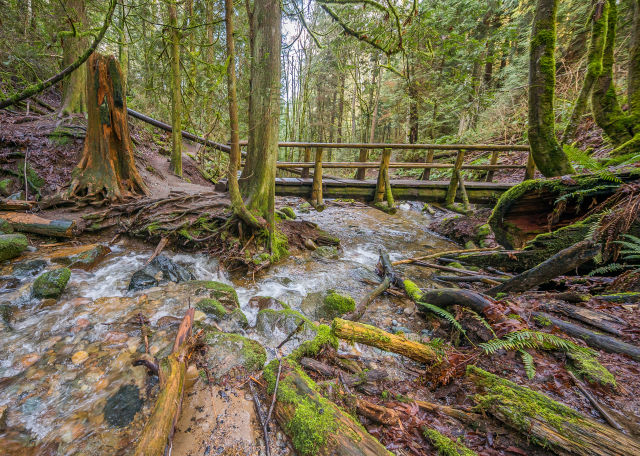
Coal Creek Falls Trail, Issaquah.
Coal Creek Falls
Round Trip Distance: 2.5 miles • Difficulty: Easy • Region: Issaquah Area • Parking Fees: None
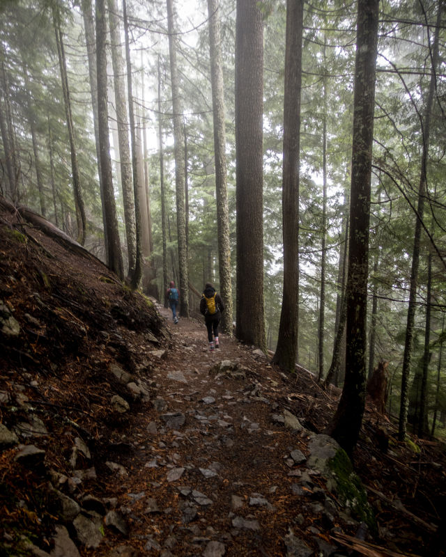
This Cougar Mountain trail is family friendly, well maintained, and laden with mossy boulders, spring wildflowers, and various ferns. Start at the Red Town Trailhead and wander under thick maple, alder, and cedar trees; follow the small but mighty Coal Creek through a deep ravine, past old mine shafts and other coal-mining remnants from the late 1800s. Now reforested, Coal Creek Park is a rugged surprise among the suburban hills. The grade is relatively flat—more a place to stretch the legs than to feel the burn.
Poo Poo Point
Round Trip Distance: 3.8 miles • Difficulty: Moderate • Region: Issaquah Area • Parking Fees: None
Start in a big field just south of Issaquah, pass the carving of a winged lion, and head up more than 1,500 feet of Tiger Mountain on what’s called the Chirico Trail. Marc Chirico, owner of Seattle Paragliding at its base, created his namesake route to reach the launch ramps cut into the side of the mountain; eat lunch and watch paragliders step off into the sky and sail over treetops. And sure, giggle at the Poo Poo moniker: The point is named for the steam whistles of old logging trains, but these days you’re more likely to hear “oohs” and “aahs.”

Rattlesnake Ledge.
Image: Anviksha Singh on Unsplash
Rattlesnake Ledge
Round Trip Distance: 4 miles • Difficulty: Moderate • Region: North Bend Area • Parking Fees: None
There’s no wait for the spectacular sites on this well-loved route; the trail begins at fisherman-friendly Rattlesnake Lake and climbs from there past mossy boulders and through gentle switchbacks. The 1,160-foot climb ends at the rock known as Rattlesnake Ledge, a spectacular natural viewing platform pointed east into the Cascades. Take care near the edges; the drop-offs are abrupt and steep.
Hiking the switchbacks on Mailbox Peak.
Image: Nate Brown
Mailbox Peak
Round Trip Distance: 9.4 miles • Difficulty: Hard • Region: North Bend Area • Parking Fees: Discover Pass
This is one for the experienced hikers. Climb long switchbacks up 4,000 feet through airy forest, then emerge at a boulder field before open meadows lead to the summit. True to its name, the peak is topped with the namesake mailbox, mounted on a stone base and maintained by volunteers. Hikers coat it in stickers and stock it with stuffed animals, notes, or even beers. Leave an item, take an item, and enjoy a breathtaking view of Mount Rainier and the Middle Fork of the Snoqualmie River.
Mount Si
Round Trip Distance: 8 miles • Difficulty: Moderate • Region: North Bend Area • Parking Fees: Discover Pass
Mount Si is Seattle’s unofficial favorite mountain—and officially its most glamorous thanks to its appearance in Twin Peaks. It’s easy to see why its rocky and imposing face and famous views attract hordes of area hikers. The strenuous 3,150-foot ascent is made worth the effort by one of the best mountain views in the Puget Sound region; most stop at the base of the bald “haystack” summit, while the brave scramble to the very top.

Snow Lake in summer.
Image: Shutterstock by Ariena
Snow Lake
Round Trip Distance: 7.2 miles • Difficulty: Moderate • Region: Snoqualmie Pass • Parking Fees: Northwest Forest Pass
The parking lot at Alpental Ski Area does summer duty as the trailhead for a well-trampled path. There are multiple sets of switchbacks on the way and a few meadows to cross before reaching this picturesque mountain site; a side trip to the Source Lake viewpoint is worth the detour. Research avalanche conditions before a winter trip, and note that snow (of course) and ice persist well into summer, especially at the crest of the saddle and on the descent to the lake. Despite the campsites and old cabin ruins just off the trail, not to mention the throng of hikers, the lake retains untamed charm.
Granite Mountain
Round Trip Distance: 8.6 miles • Difficulty: Hard • Region: Snoqualmie Pass • Parking Fees: Northwest Forest Pass
The 360-degree views from Granite Mountain are worth the rough haul it takes to see them. Grind upward 3,800 vertical feet through flower and huckleberry patches to the 5,629-foot open summit. It’s graced with a handsome fire lookout, popular despite the area’s early-season avalanche danger. Spin to see Mount Rainier and Snoqualmie Pass on the horizon, and a dazzling array of sparkling alpine lakes in the nearer distance. Resident marmots, with their trademark whistle, roam the upper reaches of the mountain.
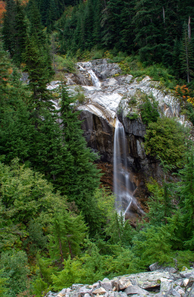
Keekwulee Falls along the Denny Creek Trail.
Image: Shutterstock by Derek Young
Denny Creek
Round Trip Distance: 6 miles • Difficulty: Moderate • Region: Snoqualmie Pass • Parking Fees: Northwest Forest Pass
You don’t have to go far off I-90 to find free fun in the summer: Denny Creek rushes down a smooth granite slab, creating a natural water slide with a shallow pool below. Bring the kids and the swimsuits, trek about a mile to the slide, then wander another half mile for photo ops in front of Keekwulee Falls and Snowshoe Falls.
Wallace Falls
Round Trip Distance: 5.6 miles • Difficulty: Moderate • Region: Highway 2 • Parking Fees: Discover Pass
The sheer power of these wooded waterfalls has a way of silencing even the crowds that line its trail on summer weekends. The hike hits a three-tiered cascade, with the middle section alone tumbling more than 250 feet. Stay behind guard rails, since the riverbanks are more treacherous than they look. Add mileage by tacking on a side trip to placid, uncrowded Wallace Lake (another few miles).
Lake Serene
Round Trip Distance: 8.2 miles • Difficulty: Hard • Region: Highway 2 • Parking Fees: Northwest Forest Pass
The trudge to Lake Serene is a beast of a climb up stone steps, gaining 1,300 feet in a mile and a half. It takes effort to finish the remaining half mile, but the rewards are great. Nestled within a forest thicket, against the northern face of Mount Index, the sparkling glacier-fed lake lives up to its name. Picnic atop Lunch Rock, a smooth stone slab that sits at the cerulean water’s edge. Or for those looking for a quicker cool-down, consider cannonballing into the watering hole—it was looking too serene anyway.

The view from Heybrook Lookout.
Image: Shutterstock by Mike Eppley
Heybrook Lookout
Round Trip Distance: 2.6 miles • Difficulty: Moderate • Region: Highway 2 • Parking Fees: None
From a small parking area just off Highway 2, a well-maintained trail ascends quickly up the hillside, pausing for only a few switchbacks. Eventually it traces the top of the ridgeline under semithick tree cover, finally reaching a clearing after about a mile and a quarter. The 73-foot lookout tower above is an intimidating climb after the uphill slog, but the view only gets better. In 2008, this swath was targeted for logging; the nearby town of Index raised $1.2 million to buy 100 acres. Mount Index is the square, sheer mountain you see directly across the Skykomish Valley to the south. You’re looking at the steepest side—mountaineers scaling Index generally approach from the opposite, shallower side.

A Lone Heron Fishing at the Billy Frank Nisqually Reserve.
Image: Shutterstock by David Maki
Billy Frank Jr. Nisqually National Wildlife Refuge
Round Trip Distance: 5 miles • Difficulty: Easy • Region: Olympia • Parking Fees: Daily park fee
The name is a mouthful but a well-earned salute to a Native American environmental leader. The Nisqually Estuary trail at the foot of Puget Sound is an easy trek on boardwalks elevated above the tidal flats. Spot beavers and weasels, not to mention birds from ducks to waxwings; more than 200 species migrate through the spot annually. A section is in gravel but it’s still largely wheelchair accessible.
Ebey’s Landing Bluff Trail
Round Trip Distance: 5.6 miles • Difficulty: Moderate • Region: Whidbey Island • Parking Fees: Discover Pass
Walk across golden bluffs that tower above the surf of the Puget Sound, then wander along a beautiful beach for views of snow-capped Olympic Mountains. There are two ways to get to the Bluff Trail: from the Prairie Overlook trailhead, or at the seaside parking lot at the end of Ebey’s Landing Road. Home to 1850s homesteads, abundant birds, and maritime beauty, the route offers some of the best hiking on Puget Sound.
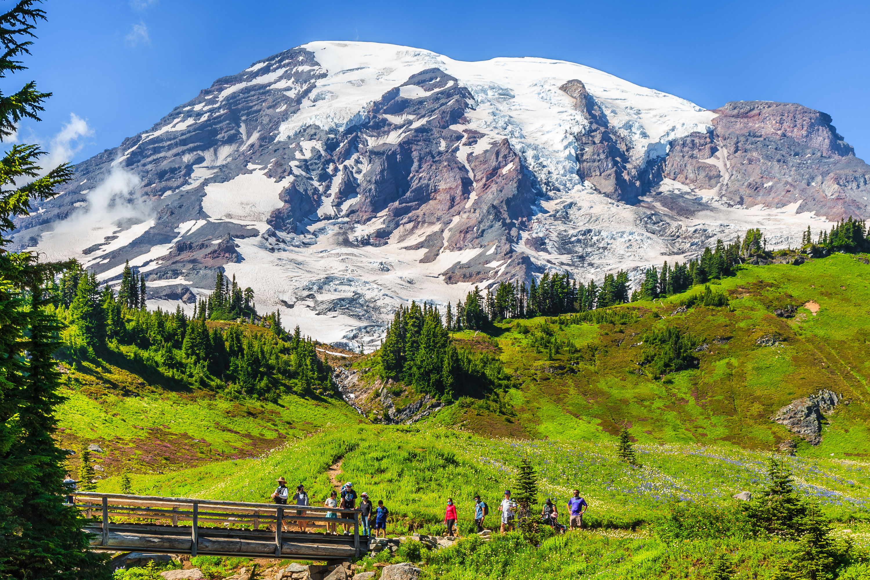
Skyline Trail
Round Trip Distance: 5.5 miles • Difficulty: Hard • Region: Mount Rainier • Parking Fees: National Park entrance fee
If there was a signature hike through the expansive meadows at Paradise, the main visitor center for Mount Rainier National Park, it would be this glorious loop. It climbs through wildflowers (in midsummer, anyway) and marmots sunning themselves on rocks before topping out at the aptly named Panorama Point; those small peaks you see at the feet of Rainier are the Tatoosh Range. (Even the pit toilet up here is scenic, built out of stone.) Pass the rushing Sluiskin Falls on the return down to the Paradise parking lot.
Naches Peak Loop
Round Trip Distance: 3.2 miles • Difficulty: Easy • Region: Mount Rainier • Parking Fees: Northwest Forest Pass
It’s a little in Mount Rainier National Park and a little out. A little less crowded than trails at central visitor base Paradise, a little more postcard-ready than hikes farther away from the mountain. The other good little: just a tiny bit of elevation gain through its vast green meadows

Backpacking at Hole in the Wall, Rialto Beach.
Hole in the Wall
Round Trip Distance: 4.0 miles • Difficulty: Moderate • Region: Olympic Peninsula • Parking Fees: National Park entrance fee
When you want to cram the entire experience of the wild Olympic coast into a single afternoon, this shoreline tramp north from Rialto Beach hits the highlights: Hop tide pools, wade a creek, scramble over driftwood, then pass through the titular hole and scurry up the headland for an even better view.

Ozette Triangle Trail.
Ozette Triangle
Round Trip Distance: 9.4 miles • Difficulty: Moderate • Region: Olympic Peninsula • Parking Fees: National Park entrance fee
Who knew a three-mile boardwalk led to one of the wildest beaches in America? Follow the cedar-planked road from Lake Ozette to Cape Alava—through a mist-shrouded forest of mossy cedars, past prairie lands where tenacious homesteaders battled incessant rains. Once you reach the beach, enjoy a three-mile stroll south with the sand under your feet, marveling at sea stacks, sea otters, and sea lions. Peer into tidal pools offering starfish and squishy urchins to ravenous gulls, or search for petroglyphs left by the Makah three centuries ago. Boardwalks can be slick, beach walking can be rough, fog and rain can be heavy—but it’s well worth it.
Marmot Pass
Round Trip Distance: 11.5 miles • Difficulty: Hard • Region: Olympic Peninsula • Parking Fees: Northwest Forest Pass
A river walk that eventually opens up to high alpine meadows and rocky, treeless expanses: If you do just one Olympic Mountains hike, make it this one. Because it’s just outside the national park, dogs get in on the game. To make it an overnight, hang a hammock by the burbling Big Quilcene River.

Ape Cave in the Gifford Pinchot National Forest.
Image: Tandemstock by Ben Herndon
Ape Cave
Round Trip Distance: 2.8 miles • Difficulty: Moderate • Region: Mount St. Helens • Parking Fees: Northwest Forest Pass
Where else in the world can you day hike through a lava tube, basically spelunk with zero experience? (Okay, Oregon. But that’s about it.) The skinny underground channel features a few fun obstacles—check “climb a lava fall” off your to-do list—and the chance to turn off the light and experience true, bone-deep darkness.
Heather/Maple Pass Loop
Round Trip Distance: 7.2 miles • Difficulty: Hard • Region: North Cascades • Parking Fees: Northwest Forest Pass
Though it’s hard to call the North Cascades’ most spectacular day hike underrated—you’ll rarely get this high-alpine trail to yourself—it’s almost impossible to overpraise it. The tour of dramatic ridges, past wildflowers and craggy peaks, is lengthy enough to justify the long drive to Highway 20.
*All distances round-trip.